Explore Jamaica With The Caribbean’s First GPS Navigation System
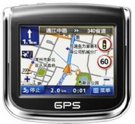
KINGSTON, Jamaica – Exploring Jamaica just got easier with the creation of the Caribbean’s first GPS Navigation map data known as JAMNAV. The Mona GeoInformatics Institute of the University of the West Indies in Jamaica has developed and released JAMNAV, offering turn by turn, voice assisted navigation across Jamaica.
The technology includes over 9,300 miles of roads and 15,000 points of interest including petrol stations, hotels, restaurants, shopping places and attractions.
“JAMNAV has been created by Jamaicans that have an intimate knowledge of its terrain, and is the first of its kind in the Caribbean. Jamaica is a wonderful island and JAMNAV will help both locals and tourists discover it in a safe and efficient way,” said Jamaica’s Director of Tourism John Lynch. “Jamaica continues to be a leader in the Caribbean tourism industry, and JAMNAV is another example of how the island seeks innovate ways to meet the needs and interests of its visitors.”

JAMNAV is based on the Garmin platform, the worldwide leader for personal navigation devices. The Mona GeoInformatics Institute (MGI) at the University of the West Indies worked as the local developer ensuring local complexities were taken into consideration such as one way streets and parochial roads.
JAMNAV is currently available from Avis Car Rental at both of Jamaica’s international airports in Kingston and Montego Bay, and is available with or without a rental car. The technology has been available since summer 2009.
Visitors to Jamaica can use the new JAMNAV technology to explore the island’s most authentic offerings. With over 150 attractions – more than any other Caribbean island – Jamaica offers travelers many reasons to navigate their own adventure. Plus, major enhancements to Jamaica’s road network make driving even more comfortable.


