[BROWARD COUNTY] – Environmental Protection and Growth Management Department has launched a new online Resilience Dashboard for municipalities, the private sector, and the public to see how investments made across the County are serving to increase resilience to local climate impacts and reduce greenhouse gas emissions to slow climate change.
Dashboard Endorsement
The County continues to build resilience on many scales. Including internally within government operations County-wide through coordination with municipalities. And, business leadership, and regionally as a partner with the Southeast Florida Regional Climate Change Compact. Initially conceptualized by Broward County Commissioner Beam Furr. The Resilience Dashboard was endorsed by regional leadership at the 2020 Broward Leaders Roundtable on Climate and Resilience. Plus the annual convening of municipal and tribal governments, the business community, and stakeholders to foster collective sharing and advancements of communications, planning and investments vital to community resilience.
Purpose of the Resilience Dashboard
The purpose of the Resilience Dashboard is to provide a single portal for County-wide resilience information, resources and projects. The dashboard brings together many of the maps and tools regularly referenced in resilience planning, tracking trends in greenhouse gas emissions and water consumption, and investments in solar projects, electric vehicle charger installations and resilience projects. The dashboard allows municipalities and tribal governments to manage their project updates and images, ensuring that content is kept current and relevant.
Commissioner Furr, who also co-chairs the Resilience Pillar of the Prosperity Partnership, celebrated the launch of the Resilience Dashboard stating, “If we are going to address the threat of climate change moving forward, we need the best tools at our disposal. This dashboard is a major piece of that puzzle, as it allows residents to get hands-on with environmental projects down to the neighborhood level. With this dashboard, all residents can examine what type of resiliency efforts are being made in their community, from seawalls to drainage and much more. It will put the power of information in your hands.”
The Resilience Dashboard, developed by County staff, hosts a story map with geo-referenced photographs describing the County and municipal strategies implemented to address flooding and beach erosion and to increase access to clean energy and freshwater. Users can review goals, objectives and actions established in the Broward County Climate Action Plan and see examples of implementation. Also shared are the Regional Climate Action Plan for Southeast Florida and the Unified Sea Level Rise Projection used to guide resilience standards and planning.
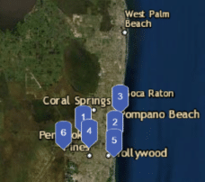
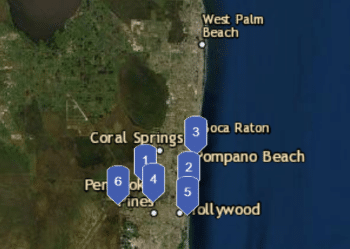
Progress on implementation of the County Commission’s pledge to reduce emissions by 80 percent by 2050 can be viewed on the dashboard’s many gauge charts which includes an inventory of emissions by source and sector, as well as the status of solar energy projects, renewable energy offsets, and electric vehicle purchases and charging station installations. A Solar and Electric tab shares the location of clean energy projects across the County, with project details and images. The Resilience Project Showcase highlights impressive examples of resilience planning and action undertaken by the County and local governments.
Interactive Maps and Tools
The Resilience Tools tab provides access to a series of interactive maps and tools:
- Priority Planning Areas for Sea Level Rise map, identifying areas at risk of future flooding.
- Future Conditions Groundwater Elevation Map, reporting future groundwater table elevations for use in drainage design and highlighting areas of constrained rainfall soil storage.
- Map of crowdsourced photos of flood events.
- Map of saltwater intrusion extent into freshwater aquifer.
- Water use per capita.
- Flood Factor, an informational tool that approximates flood risk by property.
- Flux Map, a composite of datasets that supports resilient future land use planning.
The Resilience Dashboard concludes with two tabs linking users to additional relevant resilience programs and ways to get engaged.
Dashboard Updates
Updates to the Broward Resilience Dashboard will be made regularly and shared on social media. Follow @BrowardCountyEnvironment on Facebook and @BrowardEnv on Twitter. Additionally, the information on climate, energy and sustainability initiatives will continue to be shared at Broward.org/climate.