Bahamas Geographic Information Systems conference to have regional/international impact
NASSAU, The Bahamas – More than two hundred and fifty Geographic Information Systems (GIS) Users from around the globe and The Bahamas have registered for the third Urban and Regional Information Systems Association (URISA) Caribbean Conference scheduled for October 30 through November 2 in The Bahamas.
The URISA Caribbean Conference is a specialty conference that focuses on the effective application of GIS and other information technologies among agencies in the Caribbean and is designed to inform regional and international Users about GIS Information Systems and Technology and its many applications and developments in the region.
Local organizers say the conference will have “significant impact” on local, regional and global GIS use.
The conference will be held under the auspices of the Office of the Prime Minister and the Bahamas National Geographic Information Systems (BNGIS) Centre.
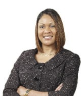
“The Office of the Prime Minister views this conference as most timely particularly as the nation is experiencing unprecedented economic development throughout our chain of islands,” said Carolann Albury, Director of the BNGIS Centre.
“GIS, as the tool of choice, will help us plan for improved stewardship and sustainability of the country’s natural resources. GIS is used throughout the world to improve the environment, health care, land use, small and large business efficiency and public and private education among many other uses,” Ms. Albury added.
Ms. Albury said the conference will provide “an interesting mix” of pre-conference workshops, plenary sessions, exhibits, poster gallery and presentations conducted by local, regional and international presenters.
She said topics to be addressed will include GIS use in disaster management, law enforcement, public health and safety, GIS Policy, Planning and Natural resources, utilities, education “and so much more.”
“The significance of hosting the conference here in The Bahamas is that it is in total alignment with the Government’s commitment to modernizing the Public Service through Geographic Information Systems and technology,” Ms. Albury said.
“GIS is the wave of the future and so the benefits we will be able to receive as a country from the networking and connectivity with other agencies and countries that use GIS in their everyday decision-making and planning will be quite invaluable,” Ms. Albury added.
Ms. Albury said one of the anticipated outcomes of the conference would be a decision to “move forward” on the development and implementation of a Regional Spatial Data Infrastructure for the Caribbean that would include the Commonwealth of The Bahamas.
She said this is “most important” for the Centre and the Office of the Prime Minister as the two entities recently established the Geospatial Advisory Committee (GAC) among whose focus she said will be the establishment of a National Geospatial Data Infrastructure within The Bahamas.
“This primarily deals with how we will share and access GIS Information and so to be able to tie in with other national initiatives, particularly in the region is extremely beneficial,” Ms. Albury said.
“If we are to use GIS in its true sense, we have to be able to share information across agencies and across nations and in order to do that we all must apply the same standards. The sharing of information can positively impact many areas including disaster management, crime fighting, public health and safety, educational standards and on and on,” Ms. Albury said.
“The URISA Conference is truly a global conference and the fact that it is being held here in The Bahamas speaks to the development of its use locally,” Ms. Albury added.
Mrs. Valrie Grant-Harry, GIS Consultant, said that the conference will allow members of the general public and small and large business owners and operators to appreciate the impact GIS Use can have on their day-to-day activities.
“The small business person in setting up a new business, for example, can use GIS Data to do their site selection to ensure that the most profitable location is decided upon. Additionally, they can use the information to conduct target marketing and demographic research, which is something the larger companies often do and which is critical to the survivability of a business,” Mrs. Grant-Harry said.
“The conference will also be an excellent opportunity for The Bahamas, from a tourism perspective, to showcase what is here. This country was specifically chosen because of the flurry of GIS activity currently taking place and because the Government has basically taken the lead for GIS by establishing the Centre as the technical focal point.
“And so it is quite timely, with all the other activities, to bring the conference here so that this could cement several of the different activities that are now taking place,” Mrs. Grant-Harry added.


